What is this survey?
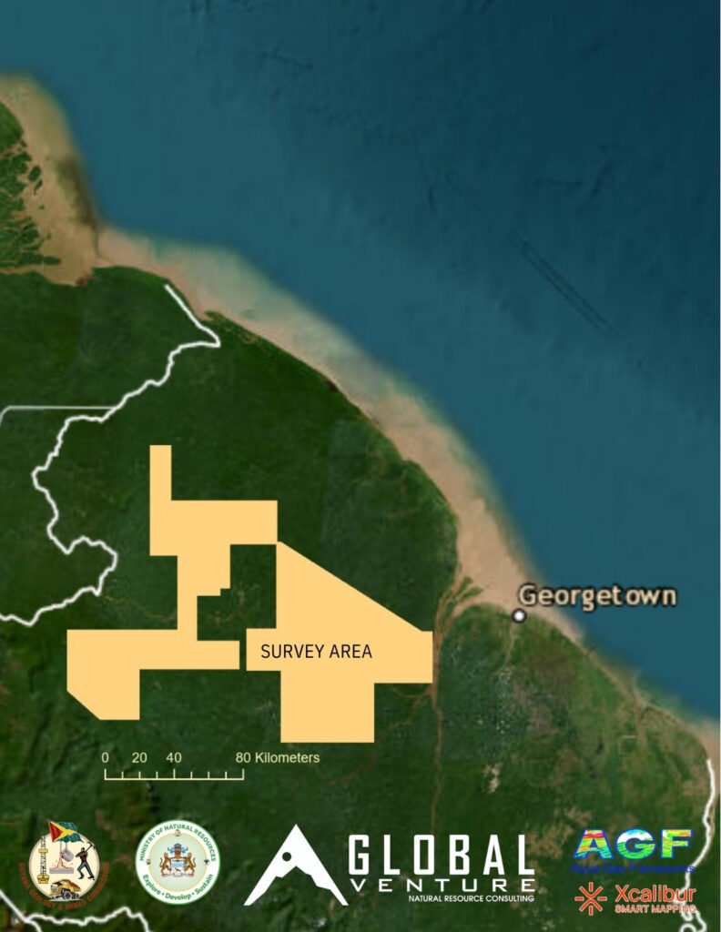
An airbornen magnetic, radiometric, and gravity geophysical survey covering 14000 square kilometers. This survey is part of Phase II of the Mineral Mapping Study of Guyana’s Mineral Resources ContractNo.: MNR/GGMC1/2025-1
How does this help Guyana?
- Improved natural resource management through a better understanding of the geology.
- Promote responsible development while empowering local miners.
- Attract high quality foreign investment through robust pre-competitive geoscience data.
Why Airborne Geophysics?
Airborne geophysical data provides continuous spatial coverage of subsurface information over areas that would not be cost or time effective to investigate with other methods. Geophysical surveys create a clearer picture of the geology below the surface. These surveys are specially valuable in areas covered by vegetation or soil, or that are inaccessible (most of Guyana!).
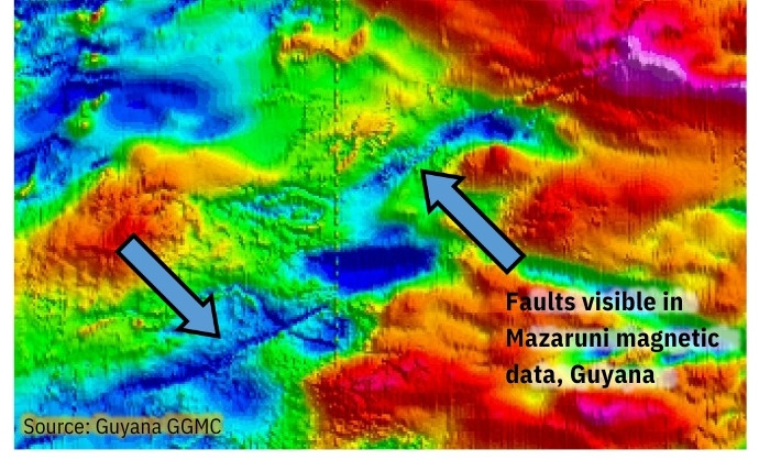
Why Magnetic Data?
Magnetic survey data are used to make maps of the local magnetic field produced by rocks. Patterns on these maps reflect rock type, faults, and alteration. In addition to geologic mapping, magnetic data are used for mineral and hydrocarbon exploration.
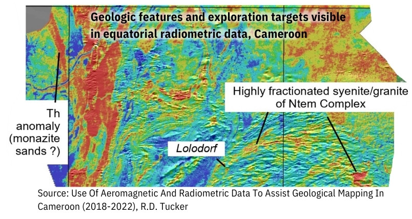
Why Radiometric Data?
A radiometric survey records the gamma ray energy emitted by trace amounts of naturally occur- ring, radioactive elements pre- sent in the first few centimeters of the earth’s surface. Levels of gamma ray energy can be used to differentiate rock types and surficial material. Radiometric data is used for geologic mapping, mineral exploration, and Radon hazard mapping.
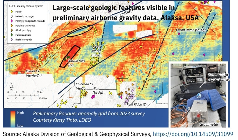
Why Gravity Data?
The strength of the Earth’s gravitational field changes depending on the density of rocks in the subsurface. These variations indicate different types of rocks, basin/fill thickness, crustal thickness, faults, and alteration. Mineral explorers, hydrocarbon explorers, and structural geologist are all users of these data.
Magnetics — residual magnetic intensity (RMI): Final leveled magnetic data with regional IGRF field removed
Magnetics — reduced to pole (RTP): These magnetic data have been processed by advanced filtering to improve the interpretability of the magnetic data by moving the magnetic anomalies over their sources and reducing the dipole nature of these data
Radiometric — Ternary
Shape Files Database
GeoPhysics Data
Request for Mineral Mapping Information
| Survey Name | Year Acquired | Traverse Line Spacing (meters) | Tie Line Spacing (meters) | Line Kilometers | Square Kilometers | Data Types |
| Aranka | 1994 | 200 | 1,000 | 1,483 | 245 | magnetic, radiometric |
| Cuyuni | 1994 | 200 | 1,000 | 976 | 163 | magnetic, radiometric |
| FiveStar | 1994 | 200 | 1,000 | 24,217 | 4,875 | magnetic, radiometric |
| Mazaruni | 1994 | 200 | 1,000 | 30,591 | 5,116 | magnetic, radiometric |
| Potaro | 1994 | 200 | 1,000 | 14,323 | 2,428 | magnetic, radiometric |
| Wenamu | 1994 | 200 | 1,000 | 6,965 | 1,477 | magnetic, radiometric |
| BHP Kaburi | 1996 | 400 | 4,000 | 600 | 210 | magnetic, radiometric |
| BHP Main | 1996 | 400 | 4,000 | 21,162 | 7,600 | magnetic, radiometric |
| GGMC 2025 | 2025 | 400 | 2,400 | 37,266 | 12,264 | magnetic, radiometric, gravity |